SusanHanson@RuralRoadsFrederickMD.org
(301) 371-9172

Highlands Tour
(55 Miles About 2 hours)

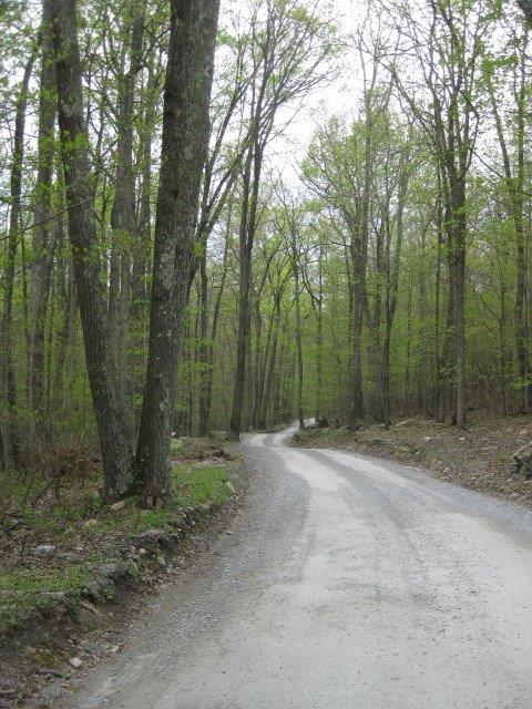
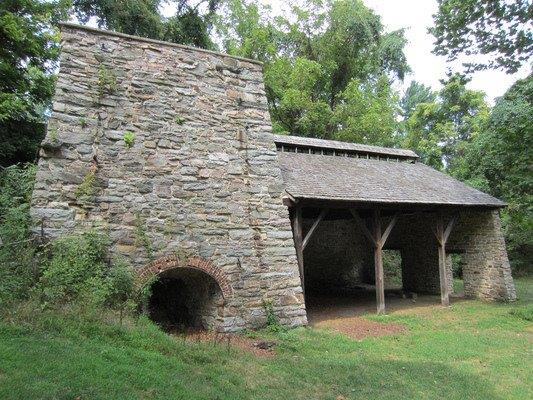
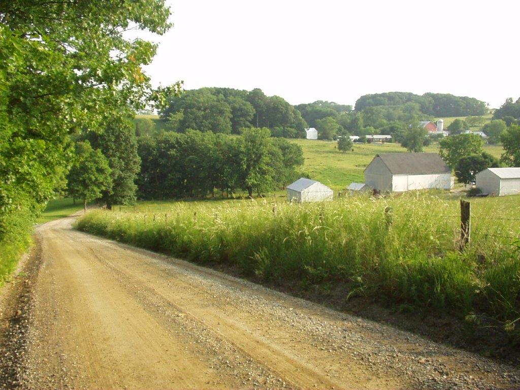
The Highlands tour starts on Route 15, just south of Thurmont, with the historic Catoctin Furnace, then  goes west through the mountain parks, and winds down the Middletown valley on the west side of the  mountains, passing through Wolfsville and Myersville. The area offers beautiful scenic views of farms  and the Catoctin foothills, as well as many, many old stone walls.

Mink Farm Rd
Catoctin Furnace
Wildcat Rd with View
  1. Take Rte 15 North toward Thurmont.
  2. Take exit for Rte. 806, the access road to Catoctin Furnace Village. In the mid-1770’s, Thomas  Johnson (later Governor of Maryland) and his three brothers established a number of forges in order to  manufacture iron. The surrounding acres of forest were used as fuel for the furnaces. This particular  “stack” was built in 1857 and was powered by steam. If you have time, park in the visitors’ lot and walk  around the site. The complex includes a small museum, the Harriet Chapel (built in 1828), the collier’s  log house, and the ruins of the Ironmaster’s mansion. There is also a trail leading to an African American  cemetery where the slaves who were brought directly from Africa for their valuable iron-working skills  were probably buried, along with the free and enslaved black labor force who worked at the Furnace.Continue on Catoctin Furnace Rd. past the Catoctin Wildlife Preserve, and watch for the sign for Blue  Mt. Rd.
  1. Turn left onto Blue Mt Rd, which takes you back to Rte 15 north.
  2. Turn right onto Rte 15 north. Pass the large interchange for Thurmont (huge American flags,  McDonalds and Mountain Gate Restaurant).
  3. Take exit for SR 77 west. At the end of the ramp, turn right onto Rte. 77 west. Drive about 5 miles. This road (Foxville/Rocky Ridge Rd.) will take you right across Catoctin Mountain Park (on your  right) and Cunningham Falls State Park (on your left).Catoctin Mountain Park contains two special areas built by the WPA in the 1930’s, the most notable  being Camp David, the Presidential retreat. Numerous international summit meetings have been held  there, and it is a Naval Support Facility. The second camp is Camp Greentop, a series of log cabins that  were designed to accommodate handicapped children – one of the first handicap-accessible facilities in  the country. In addition, there is an easy hike to the Blue Blazes Still, if you are interested.Watch for an old stone house on right and a yellow sign announcing Stottlemyer Rd. 6. Turn left onto Stottlemyer Rd. and drive just 0.25 mile to Old Catoctin Rd. 7. Turn left onto Old Catoctin Rd. Drive to the stop sign at Tower Rd.
  1. Bear right onto Tower Rd., and drive about 1 block to Fox Tower Rd.
  2. Turn left onto Fox Tower Rd. Both of these roads were probably named for the Foxville Fire  Tower which is farther south on Tower Rd. The tower was built in 1918 due to “frequent incendiary fires  in this section, attributable in part to the firing of the woods to improve growth of huckleberries, and in  part to general “cussedness.”” In 1928, Miss Alice Willard was appointed lookout, the only woman in  such a position in Maryland.Drive to the stop sign at Wigville Rd.
  1. Turn left onto Wigville Rd, drive about 0.25 mile to next stop sign.
  2. Turn right onto Catoctin Hollow Rd and drive toward Mink Farm Rd. Go to the first intersection on your right.
  3. Turn right onto Mink Farm Rd. The Old Mink Farm Recreation Resort (at 12806 Mink Farm Rd.) on your right was originally a mink farm established by Kingman Brewster, a Washington lawyer, in  1937. He started with 10 animals, and by its heyday, there were 2000 minks on the farm, giving  Brewster a substantial profit on his investment. With the beginning of WWII, however, it was almost  impossible to find staff to keep the farm operating, and the government put a cap on the amount of  profit that could be made on pelts. The farm closed in 1942, and it wasn’t until the 1960’s that Gordon  Irons bought the land that would become Old Mink Farm Recreation Resort.About 0.5 mile beyond the Resort, watch for an entrance on your left for Thorpewood, a 155-acre  retreat that offers nature programs and event venues at its beautiful lodge. The property was  purchased as a mountain retreat by another Washington lawyer named Merle Thorpe, Jr. in 1960. Mr.  Thorpe was particularly interested in various species of trees (hence the name Thorpewood), and there  is now a private orchard dedicated to the re-establishment of the American Chestnut, which died out in  the US in 1950.Continue on Mink Farm Rd. for another 0.5 mile, watching for Tower Rd to come in from the right.  (Mink Farm Rd merges Tower Rd at this point.)
  1. Bear left onto Tower Rd. Drive about 0.5 mile. Watch for a mailbox at 12360 and a lane on the  right going down to a house with a green roof and green garage doors. Just beyond that, watch for the intersection with Middlepoint Rd. coming in on your right. There is a modern log cabin on your right at  this corner.
  2. Turn right onto Middlepoint Rd. Drive 1.8 miles to the stop sign at Wolfsville Rd. (SR 17). Middlepoint was a village that was midway between Wolfsville and Myersville.
  3. Turn right onto Wolfsville Rd (SR 17). Drive 0.5 mile. Watch for a yellow sign indicating Spruce  Run Rd., which is just beyond the concrete bridge over Middle Creek.
  4. Turn right onto Spruce Run Rd. Drive 0.1 mile. Drive over a short bridge at the creek and to a  fork in the road.
  5. Bear left at the fork onto Hayes Rd. (Hayes becomes a gravel road.) Drive a mile or so to a  stop sign. At this stop sign, cross Stottlemyer Rd., staying on Hayes Rd. (Hayes looks like someone’s  private lane here, but it really is a public road.) Continue to the stop sign at Brandenburg Hollow Rd.
  6. Turn left onto Brandenburg Hollow Rd. Pass the Wolfsville Ruritan Community Park on your  right. Drive to the stop sign at Stottlemyer Rd. There is a large pond on the corner at this intersection.
  7. Turn right onto Stottlemeyer Rd. Drive just 0.1 mile to the stop sign at Wolfsville Rd. (SR 17) Wolfsville is a “crossroads” village that was settled in the 1700’s by the Wolf family. The gray building  on your left at the stop sign is the old Milton W. Harnes store, now a convenience store that sells  delicious sandwiches!
  8. Turn left onto SR 17 (Wolfsville Rd.) As you make this left., the stone house on your right  belonged to Jacob D. Wolf, and was later turned into a shoe shop.Drive 0.5 mile to the Salem United Methodist Church. At the end of the church parking lot, turn left to  stay on SR 17. (Do not go straight onto Harp Hill Rd.) Pass the Wolfsville Fire Co. on your right.Drive about 0.8 mile. Pass a white barn with red roof and a red door on your right, drive through a small  grove of trees, and watch for a yellow sign marking Wildcat Rd. (If you come to a yellow sign  announcing Spruce Run Road, you have gone too far. Turn around and go back to Wildcat Rd. and turn  left.)
  1. Bear right onto Wildcat Rd., a gravel road. Drive 1.1 mile. through open pasture land and watch  for longhorn cattle on your right!! Wildcat Rd. is probably typical of the roads used by Catoctin  moonshiners during Prohibition to escape pursuers. Remember the Blue Blazes Still up in the Catoctin  Mt. Park (#5 above)? In 1929 there was a famous raid there by the Sheriff’s Department. Blue Blazes  was the largest still in the area, and was destroyed by the Sheriffs, but a local man was killed.  Apparently, this only served to antagonize the locals for years to come.Go to the stop sign at Meetinghouse Rd.
  1. Turn right onto Meetinghouse Rd. Drive to the stop sign at Harp Hill Rd.
  2. Turn left onto Harp Hill Rd. Drive about 2 miles, admiring the views, to a stop sign at Wolfsville  Rd. (SR 17).
  3. Bear right, crossing the bridge, and turning onto Wolfsville Rd. (SR 17). Watch for a yellow sign  indicating East Church Hill Rd.
  4. Turn right onto East Church Hill Rd., crossing the Church Hill Road pony truss bridge, built in  1908. Watch for a yellow sign indicating a road on the left, just beyond a pond (also on the left).
  5. Turn left onto Church Hill Rd. (Note the tiny Summers family cemetery on right, surrounded by  cedar trees) Continue to the stop sign at Baltimore National Rd. (US 40). Cross Baltimore National Rd.  (US 40). Continue toward Myersville on Church Hill Rd. Continue to the stop sign at Canada Hill Rd. The  Mt. Zion United Methodist Church and cemetery are on your left at this intersection.
  6. Turn left onto Canada Hill Rd. [The new Myersville Community Library can be found at the first  left turn off Canada Hill Rd, on Harp Place.] Canada Hill Rd. becomes Main St. here. Continue through  town on Main St.NOTE: If you have time, stop at the Trolley Station on your left, just beyond the intersection  with Rte. 17. From 1898 to 1945, an electric trolley ran through Myersville between Frederick  and Hagerstown. An original trolley car is on display at the Myersville Public Library.Pass the Myersville Municipal Center and fire house on your left. Drive one more block to the red brick  Brethren Church on the corner of Poplar St.
  1. Turn left onto Poplar St (which becomes Brethren Church Rd.) Continue out of town on  Brethren Church Rd. to a stop sign at Baltimore National Rd. (US 40).
  2. Turn right onto Baltimore National Rd (US 40), heading south. About a mile down the road, the Maryland National Golf Course is on your right at Hollow Rd. If you need a break, there is a good public  restaurant there called Shroyers Tavern. About a mile beyond the golf course, on your right near PacificDrive, is Surreybrooke, a small garden center with beautiful landscaping and winding paths. About  another mile down the road, you will drive through a section of road with rocks high on either side.  Watch for a yellow sign announcing Shookstown Rd. on the left. Turn on your blinker to alert cars  behind you about your coming left turn!
  1. Turn left onto Shookstown Rd. Drive to the stop sign at Gambrill Park Rd. The Park offers 16  miles of hiking trails and high overlook views of the Frederick and Middletown valleys. (Turning left here  would take you to the Park entrance.) Go straight across the intersection and continue on Shookstown  Rd. about 5.0 miles into Frederick. There were many Shook family farmers in the area, going back to the  1700’s, as evidenced by a small cemetery on Kemp Rd. As you pass Kemp Rd. on the left, you come to  the infamous “Area B” of Fort Detrick – a biological warfare testing ground from 1946 to 1974. Shookstown Rd. becomes Montevue Ave and ends at the traffic light at Rosemont Ave and the west side of Fort Detrick. Montevue Assisted Living, on your left at this intersection, was originally an almshouse  run by the County for the indigent, blacks, and the mentally ill.
  2. Turn right onto Rosemont Ave and take the ramps onto Rte. 15 as desired. 

END OF TOUR