SusanHanson@RuralRoadsFrederickMD.org
(301) 371-9172

The Catoctin Creek Tour

45 miles, approximately 2 Hours

There are 5 separate tours of Frederick County’s Rural Roads. The selection of roads for these tours is being revised to celebrate the 20th Anniversary of the enacting of the county’s Rural Roads Program.

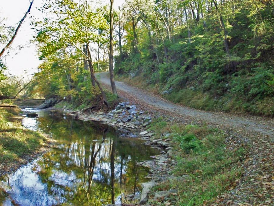
Each Rural Road in the program contributes to the county’s rural character both as glimpses into what life used to be like, and as champions of natural beauty. We hope that this trip will motivate you to find the other Tours and become a supporter of these beautiful roads.

All of the county’s Rural Roads contain sections that are single lane, narrow, curvy and hilly. They are all beautiful gems. The roads in the Rural Roads Program that you will be driving on in this tour are capitalized and underlined. Some roads have been excluded for safety and brevity. Do not attempt this tour during inclement weather, at night, or in a low-hung vehicle. Please drive slowly and cautiously. Enjoy!

Tour #5, The Catoctin Creek, starts west of Middletown, on Shank Road. It includes roads west and south of Middletown, including some roads that played a critical role in the Battle of South Mountain. The tour continues south around the town of Jefferson and follows the Catoctin Creek almost to Lander, the forgotten village adjacent to the C and O Canal.

  1. From the Safeway parking lot in eastern Middletown, turn right (west) on Alt 40 and drive for 3.4 miles (through Middletown) to Shank Road. There is a white frame house with a red roof on the right, just before the turn.
  2. Turn right onto Shank Road, which meanders along the Catoctin Creek. In 1910, Charles M. Shank was proprietor of the South Mountain Creamery. Drive 1.1 miles to the stop sign. Directly in front of you is a beautiful stone wall – one of many that were used by soldiers during the Civil War battles in this area.
  3. Turn left onto Station Rd. Drive 1 mile to stop sign. On your right is the Mt. Tabor Cemetery, part of the Zion Lutheran Congregation of Middletown. Many graves from the 19th century.
    NOTE: You are now entering an area called Fox’s and Turner’s Gap Historic District. During the September 14, 1862 Battle of South Mountain, the primary push of Union troops took place over the roads leading over the mountain at Turner’s Gap and Fox’s Gap and the adjoining woodlots and fields.
  4. Turn right onto Mt. Tabor Rd. Drive just .1 mile
  5. Turn left onto Frostown Rd. Drive .5 mile. On the right at 9117 is a large red barn, part of the Lucy School. This is a fine example of adaptive use of the historic barn and green architecture in the classroom behind. You will come to a second large red barn on the right, where there is a fork in the road. You want to keep left onto Dahlgren Rd. Do not follow Frostown Rd.
  6. Bear left onto Dahlgren Rd. Dahlgren Rd was an active throughfare for both sides during the Battle of South Mountain. The road was named for Adm. John A. Dahlgren, who invented the Dahlgren cannon, and who was in charge of the Southern coast blockade during the Civil War. Drive 1.5 miles to the stop sign. Just out of sight to your right is the Dahlgren Chapel, the South Mountain Inn, and Washington Monument State Park with access to the Appalachian Trail.
  7. Turn left onto US Alt 40 (East). Drive 1 mile down the mountain. Your next turn is just beyond an old stone house on the right. This the Beachley House (or White House Inn), built in 1792. It is said that General Lafayette, Daniel Webster, and Henry Clay all dined there.
  8. END OF TOUR
  9. Turn right onto Fox Gap Rd. This was one of the earliest trails used by the settlers in the early 1700’s. Drive .9 miles to the stop sign.
  10. Turn left onto Reno Monument Rd. The road is named for a monument dedicated to Union General Jesse Reno, who was mortally wounded near here in the Battle of South Mountain. Drive .3 miles to the stop sign.
  11. Turn right onto Bolivar Rd. (Leaving the Fox’s Gap Historic District). On your left is the South Mountain Creamery, where you can stop for ice cream and take a tour of the farm. They claim to have 16,000 chickens in addition to dairy and beef cows. The road was named for Simon Bolivar, the South American liberator and founder of Bolivia.
    Pass Geaslin Dr. Watch for a stone building on your right. Get ready to turn there. The building is the historic Fox’s Tavern, which was built in 1780 as a tavern on what was called the Sharpsburg Rd at the time.
  12. Turn right onto Marker Rd. Enjoy this beautiful farm country!!
    Pass the intersection with Bidle Rd. (near the overhead power lines). Keep left at the intersection with Mountain Church Rd. (coming in on your right) to stay on Marker Rd. Watch for yellow road sign announcing a sharp turn at Quebec School Rd.
  13. Turn left onto Quebec School Rd. Enjoy more beautiful farms plus a view of the mountains. Continue across Picnic Woods Rd. (where there is a stop sign) and continue to the stop sign at Burkittsville Rd (SR 17).
  14. Turn right onto Burkittsville Rd. (SR 17.) Drive just .3 miles. Watch for yellow sign announcing Bennies Hill Rd. The turn is hard to see, but there is a sign warning trucks about turning there.
  15. Turn left onto Bennies Hill Rd. As the road descends to the Catoctin Creek, it becomes narrow with very limited visibility. At .4 miles, the road turns left and crosses Catoctin Creek on the Bennies Hill Rd Bridge, a rare iron bowstring pony truss bridge. The road meanders long Catoctin Creek and Cone Branch, one of its tributaries. At .9 miles, just past the small bridge over the creek, the red brick house on the left was the miller John Shafer’s house. John and his son Peter operated 4 mills in the Middletown area in the first half of the 19th century. They ran saw, flour, and woolen mills. Apparently, much of the lumber was used by coopers to make whiskey and flour barrels. Bennies Hill Rd. becomes Roy Shafer Rd.
  16. Keep right onto Roy Shafer Rd. for .2 miles to Paul Rudy Rd. on the right.
  17. Turn Right onto Paul Rudy Rd. for .8 miles to Sumantown Rd. There is an intersection but no stop sign. Continue straight.
  18. Continue straight to get onto Sumantown Rd. for 1.9 miles to Broad Run Rd. (SR 383). At .4 miles, the road crosses Catoctin Creek on a steel Pratt through-truss bridge probably built around 1910. At .5 miles on left is the new Catoctin Creek Nature Park, with its vegetated green roof design, and geothermal HVAC system. At 1.5 miles, bear left to stay on Sumantown Rd. (Harley Road comes in from the right.) Continue to the stop sign at Broadrun Rd.
  19. Turn left onto SR 383 (Broadrun Rd.) for just 200 feet. Watch for the first left turn – between two white houses.
  20. Turn left onto Poffenberger Rd. for 3.6 miles. At 1.0 miles, the road crosses Catoctin Creek on an iron through-truss bridge built about 1878, and meanders along the creek. Pass Carroll Boyer Rd. At 2.3 miles is an 1810 Historic Grist Mill (Lewis Mill), now a private residence. Also, Frederick County’s experimental Driving Surface Aggregate test site begins at 1.8 miles. This is a special formulation of gravel including fines, applied wet, and then rolled to give a tight road with less dust and potholes. Drive carefully up the hill to the stop sign.
  21. Turn right onto Old Middletown Rd for .6 miles. On your right at 4804 is the George Willard House, built in 1818, along with a tannery. Continue to the stop sign at Jefferson Pike. You are entering “downtown” Jefferson.
  22. Turn right onto SR 180 West (Jefferson Pike). Hemp’s Meats is immediately on your right. This shop has been thriving for more than 5 generations. On the left a bit further along is the Jefferson Market, where you can get sandwiches and snacks. As you pass a low white commercial building on your right, prepare to keep right to stay on SR 180 West as the road forks. Pass Gene Hemp Rd. on the left. Cross Catoctin Creek. The road winds uphill and crosses over SR 340. Pass the Faith Baptist Church on the right. Watch for the yellow road sign marking Olive School Rd.
  23. Turn left on Olive School Road. Enjoy all the farm scenery! At 3518 Olive School Rd., almost to the end, stands the actual Olive School. It is a one-story red frame building on your right. This was the school for white children in 1890, and an almost identical building across the road was the Olive Colored School. (The latter is now a private residence.) Drive to stop sign.
  24. Turn left onto SR 464 (Point of Rocks Rd.) Just beyond the Catoctin River Bridge, on the right, at 2609, is a private lane that goes back to the Benjamin Rice Mill that was originally built in 1792. Pass Horine Rd. Pass signs for C & O Canal and the Catoctin Aqueduct. Watch for a low white building on the right, and prepare for left turn.
  25. Turn left onto Lander Rd. At 1.0 miles, turn left at stop sign to continue on Lander Rd. Drive for 1.4 miles to SR 340 onramps toward Frederick or Brunswick. If you continue past the highway ramps, the Jefferson Park and Ride is on your right. Ahead on the left is Jefferson’s Little Red Barn – good sandwiches and ice cream. And if you turn left at the light and immediately on the left is Watson’s Fried Chicken.

Happy Trails!