SusanHanson@RuralRoadsFrederickMD.org
(301) 371-9172

Emmitsburg Area Tour

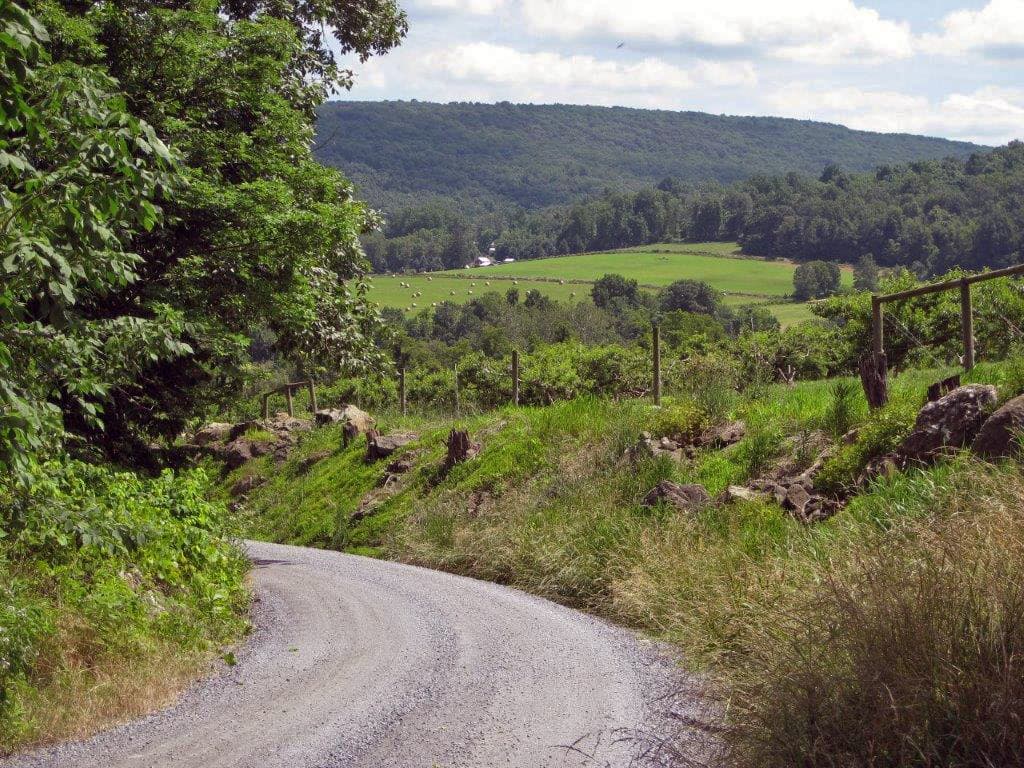
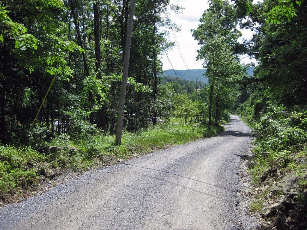
The drive begins by heading north on US 15 from Frederick. South of Emmitsburg, you will head east on Motter Station Road to ride through rolling hills and beautiful farmland. Then the tour takes you west back across US 15, through downtown Emmitsburg, and up into the Catoctin Mountains where you will find winding forested roads and open scenic views of Eylers Valley. The road signs are frequently confusing, and the roads can be very narrow, so please take your time!

Buck Lance Road
Eylers Valley
Emmitsburg Tour
  1. From Frederick City, get onto US Route 15 North. US Route 15 stretches from South Carolina to New York State. It is one of the original United States Highways (1926). In 1927 the Frederick-Emmitsburg Turnpike was incorporated into US 15. Originally US 15 went through Frederick on Market Street. There have been many realignments of US 15 over the last 60 years.The area south of Thurmont has been home to numerous productive fish hatcheries for 100 years, as evidenced by Fish Hatchery Rd., which crosses US Route 15 just above Fishing Creek. The Clemons and Eton families have operated these businesses and sold millions of koi and goldfish, among other species.Pass the Catoctin Mountain Zoo, which started as a Serpentarium, or snake farm back in 1933. Gordon Gaver opened the farm to attract tourists to Frederick County when the new federal highway was built.

    Thurmont was originally named Mechanicstown when it was founded in 1751, but the name was changed in 1894. The current name is derived from the German word thur and the Latin word mons – roughly translated to “Gateway to the Mountains.”

  2. Beyond the exits for Thurmont, turn right onto Motters Station Road (SR 76). Go about 1.8 miles and watch for two white cinder block structures – one to the left, and one ahead of you. Turn left just before the far building. This area was a busy stop on the Emmitsburg Railroad which ran from 1875 through 1940, as part of the Western Maryland Railroad.
  3. Turn Left onto Four Points Road. Follow Four Points Rd. for about 1 mile. Look for a dilapidated red barn on the right, and in about 100 yards, Four Point Rd. takes a jog to the left. The road sign is confusing. If you drive straight, you will be on Six Bridges Rd., so take the left turn and continue another mile on Four Points Rd. You will come to a stop sign and a steel bridge on the right.
  4. Turn right onto Keysville Rd. and go over the one-lane steel truss bridge built in 1876, which crosses Tom’s Creek. After crossing the bridge, keep to the right (do not turn onto Simmons Rd.). Pass an intersection with Sixes Rd., which crosses Keysville Rd. Then watch for a red brick house with a white porch on the left.
  5. Turn left onto Gregg Rd. On the left is an historic brown stone house built in 1870 that belonged to the Gregg family. Continue on Gregg Rd. for about 1 mile. You will drive through a wooded area to a stop sign.
  6. Bear left onto Bridgeport Rd. Drive only about .1 mile to the stop sign.
  7. Turn right onto Simmons Rd. Drive about 1.3 miles to a stop sign at Taneytown Pike (SR 140).
  8. Turn left onto Taneytown Pike (SR140) and drive about 1 mile. Watch for the sign announcing an intersection with Bollinger School Rd.
  9. Turn right onto Bollinger School Rd. Watch for 17218, a white house and outbuildings on your left. This was originally the Cattail Branch Schoolhouse, but is now a private residence. Pass the two intersections with Bull Frog Rd, which crosses Bollinger School Rd. About .5 miles after Bull Frog Rd, Bollinger School Rd. jogs left, but you want to go straight onto Shoemaker Rd. It looks like a small lane, but drive straight onto Shoemaker, keeping the white house on your left.
  10. Follow Shoemaker Rd., a gravel road, about 2 miles, passing the Shoemaker Homestead, a brown stone dwelling dating from 1840. There is an archeological site on this Road called the Shoemaker Village where materials from the period 900 to 1300 A.D. have been found. Continue to the Monocacy River and Starners Dam Bridge. If you cross the bridge, the dam is upstream on your left, and you have entered Carroll County. Turn around wherever possible and go back across the bridge, following Shoemaker Rd. back to Bollinger School Rd.As a side note, back around 1907, there was controversial legislation called the Shoemaker Road Fund which provided State money to build or improve roads. Apparently, the State would pay for half of the costs if the County paid the rest. Residents requesting such a road to their properties were also assessed a percentage of the cost. For years, roads throughout Maryland were called Shoemaker roads if funded in this manner.
  11. At the stop sign, continue straight from Shoemaker Rd. onto Bollinger School Rd. Pass Bull Frog Rd intersections again. returning to the intersection with Taneytown Pike (SR 140).
  12. Turn right onto Taneytown Pike (SR 140) and drive about 3 miles to downtown Emmitsburg, where Taneytown Pike becomes Main St. Emmitsburg is home to Mt. St. Mary’s University, the National Emergency Training Center, and the National Shrine of Elizabeth Ann Seton, the first American-born Catholic saint. [If you wish to take a break, there are numerous small restaurants within walking distance of W. Main St, as well as the Antiques Mall about 2 blocks south of Main.]
  13. Continue through Emmitsburg, passing the traffic light at Seton Ave., to about the 500 block of West Main St., where you will see an old, 3-story red brick building with porticos directly in front of you. The road forks at this point, and you want to turn left before you come to the house.
  14. Turn left onto Annandale Rd. Drive about 1 mile, passing over Tom’s Creek to a fork in the road.
  15. Bear left onto Frailey Rd., and go just about .1 mile to Annandale Rd.
  16. Bear right onto Hampton Valley Rd. and drive for only about 100 feet. There is a log cabin on your left.
  17. Turn right onto Riffle Road for about .5 mile and watch for a left-hand fork in the road.
  18. Bear left onto Hornets Nest Rd. and follow it uphill for about 2.5 – 3.0 miles. You are now driving along the border of Pennsylvania. Watch for a gravel road coming in from the right as you pass over a small creek. This is Friends Creek Rd. Get ready to turn.
  19. Bear left onto Friends Creek Rd. and drive for 1.7 miles, with the creek on your left. When you see the white frame Friends Creek Church of God on the right, the road turns left over the Friends Creek Road bridge, a pony truss bridge built in 1910. After the bridge, keep right to follow Friends Creek Rd. to its end, with the creek now on your right.Watch for 7131 Friends Creek Rd., a white ranch house on your left, and then 7107 Friends Creeks Rd, a red and white 2-story frame house on the left. Your next turn is just beyond that house.
  20. Make a sharp left onto Eyler’s Valley Rd. and drive about 1.9 miles to the Eyler’s Valley Chapel, where the road comes to a T-intersection with a stop sign. This stone building was erected in 1857, and is still in use, even without electricity. There were many Eylers among the early settlers of Frederick County.
  21. Turn right onto Hampton Valley Rd. which becomes Eyler’s Valley Rd. again, and travel another 2.5 miles. Enjoy all the stone walls! Keep left at the fork – DO NOT go onto Eylers Valley Flint Rd.!! After you pass Three Springs Rd, there are many privately owned fishing camps along Little Owens Creek. Drive to the end of the road, where there is a stop sign.
  22. Turn right onto Kelbaugh Rd. for about .6 mile. Watch for a yellow sign indicating a road coming into Kelbaugh from the right. This is your turn, so proceed carefully!
  23. Turn right onto Black Rd. Drive about 2 miles. Keep to the left, passing the intersection with Three Springs Rd. again, until you reach a stop sign, with an old red barn on the right. The John Eyler Homestead is about ¼ mile to your right on Eylers Valley Flint Rd, but it is privately owned now. Do not turn right!
  24. Turn left onto Eylers Valley Flint Rd., and drive .1 mile.
  25. Turn right onto Debold Rd. and drive about 2.4 miles to the end of the road.
  26. Turn left onto Sabillasville Rd. (SR 550). Drive about 5 miles, passing the Scenic View Farms produce stand and Sabillasville Elementary School. You are now driving along the northeastern edge of Catoctin Mountain Park, where Camp David is located. Officially known as Naval Support Facility Thurmont, and controlled by the U.S. Navy, Camp David was originally named Hi-Catoctin. During the Great Depression it was built as a camp for government agents and their families by the Works Progress Administration (1938). The area had been deforested by timbering, and by years of making charcoal for the iron furnaces nearby. The WPA, and the Civilian Conservation Corps transformed it into a recreation area while putting people back to work. During World War II it was decided President Franklin D. Roosevelt needed a retreat closer than Hyde Park, and that a higher elevation would be better for his health. The camp became “Shangri-La”, a fictional paradise in the novel Lost Horizon by James Hilton. Later President Dwight D. Eisenhower renamed it “Camp David” for his grandson and his father.
  27. As you approach the city of Thurmont, there is a ramp back onto US 15 South for Frederick.NOTE: If you would like a rest stop before heading home, continue on Sabillasville Rd. (SR 550) which becomes Church St. in downtown Thurmont. You can turn left onto Main St. for shops and small restaurants. When you are ready to head South again, Main St. takes you back out to US 15.

Happy Trails!